
There are three options for Base Maps: Streets, Hybrid and Imagery (all provided by Bing). Tap the buttons to toggle the different base maps. In addition to the base maps you'll notice Henderson County GIS layers, these layers will only be turned off when the Imagery opion is selected.
Enter the search parameter into the search box and click Go!. When searching by owner name enter last name first (ex. smith, will). You can also search by Parcel Number (ex. 0700214) or PIN (ex. 9653947789). Searching by address is also an option, it can be either a complete address or partial (ex. 123 Main St or Main St). The results display on the right side of the screen. Click on the Zoom button to zoom and open an infowindow with more information about the parcel. Tap the Clear button to remove map graphics and results.
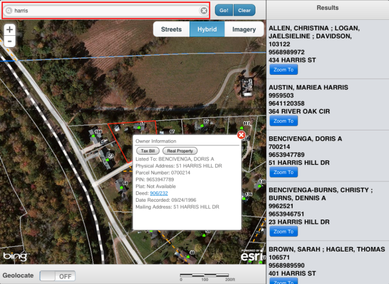
Tapping anywhere inside of Henderson County will display an infowindow with data about the parcel tapped.
Inside the infowindow you will notice two buttons at the top, labeled "Tax Bill" and "Real Property". Tapping those buttons will open the Tax Bill and Real Property sites for the selected parcel. There are also links for Deeds and Plats when available.
Sliding the Geolocate option to On will zoom the map to the users current location and display graphic at the location. Sliding the Geolocation option to Off will remove the graphic.